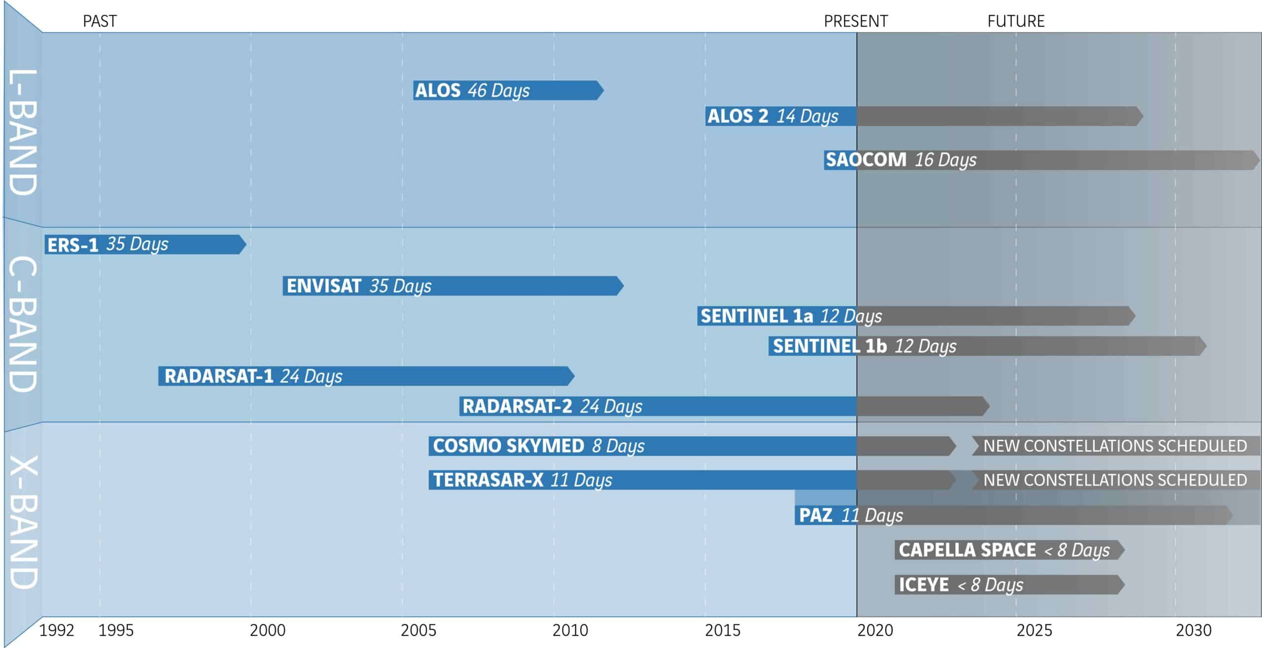
Satellites have been collecting images of the earth’s surface since 1992, enabling ATLAS InSAR historic studies to be completed.
These images are usually archived, and can be accessed so that the data can be processed to measure and map historic ground and structure motion.
ATLAS InSAR technology can determine where, and by how much, the ground has moved in all areas where images have been acquired.
ATLAS InSAR is the only monitoring technology that provides an opportunity to understand and plot historical ground and structure motion of areas or structures where sensors had not been installed.
Measuring ground motion from space
Using InSAR (Interferometric Synthetic Aperture Radar) technology, SIXENSE’s ATLAS satellite solution allows millimetric-precision measurements of the ground, structures and live construction sites.
Measurements obtained from satellite cover vast areas without any ground based intervention.
InSAR can provide detailed information on terain deformation, which could be due to works carried out on it, or other such events, permiting an understanding of the change to the impacted area.
Historic ground deformation and asset motion can be detected using SAR satellite images collected since 1992.
Space Agencies (ESA, JAXA and NASA amongst others) launched satellites with SAR sensors as early as 1990. These satellites were actively acquiring images worldwide. Today, SIXENSE can download and process these historic images to precisely map and understand past ground and asset behaviour.
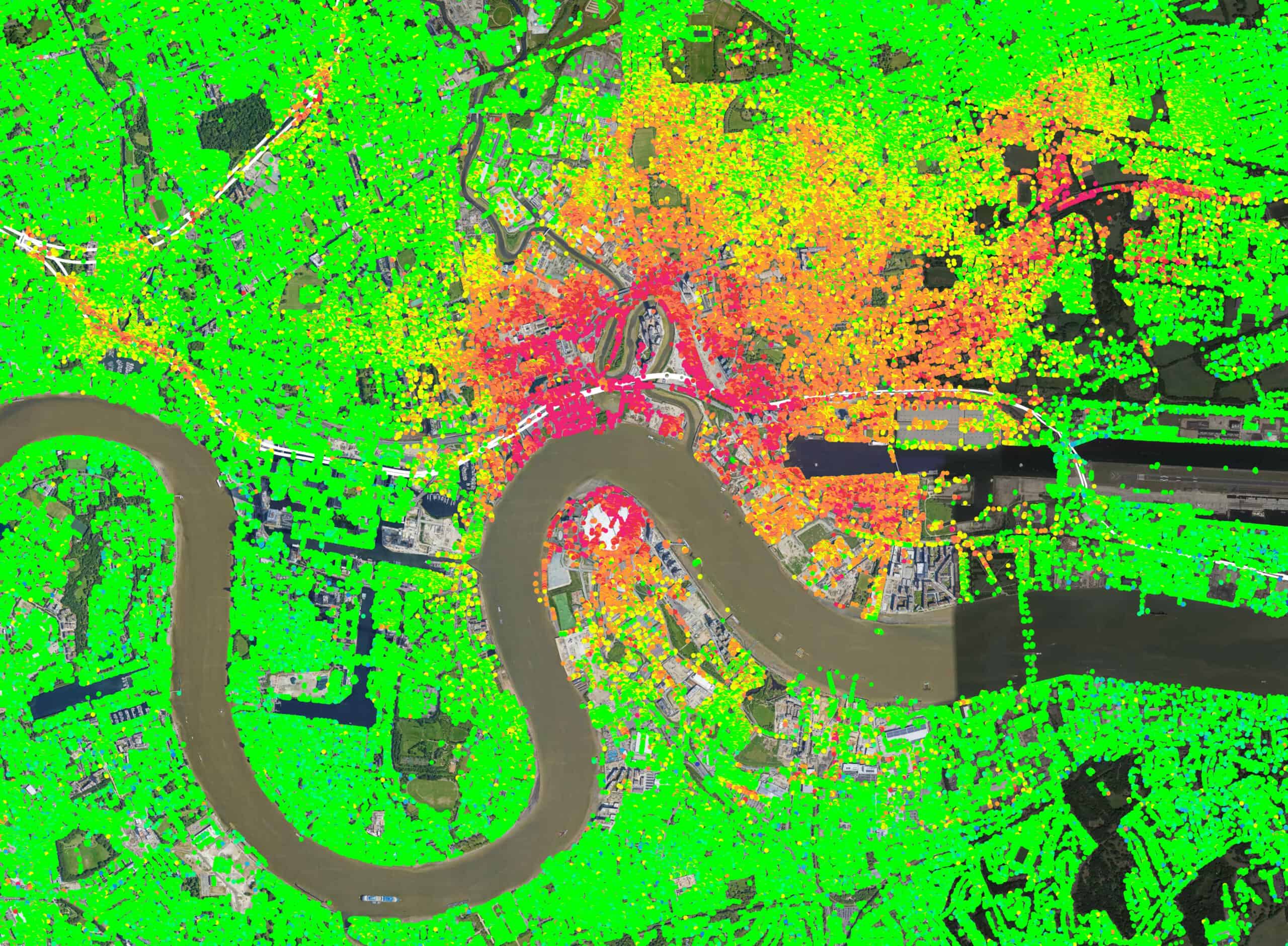
In the last decade, available archives of high-resolution satellite imagery of major cities enabled the measurement of pre-existing deformation in urban areas, or of individual structures, with high accuracy.
Understanding terrain behaviour for project planning and design
During the planning and design phase of any type of infrastructure, ATLAS historical studies can provide a retrospective understanding of deformations affecting future construction sites as well as the precise analysis of terrain evolution over time.
ATLAS is a value added tool for site selection and characterisation prior to the commencement of any works.
Inventory of critical spots along large sites, such as linear infrastructure
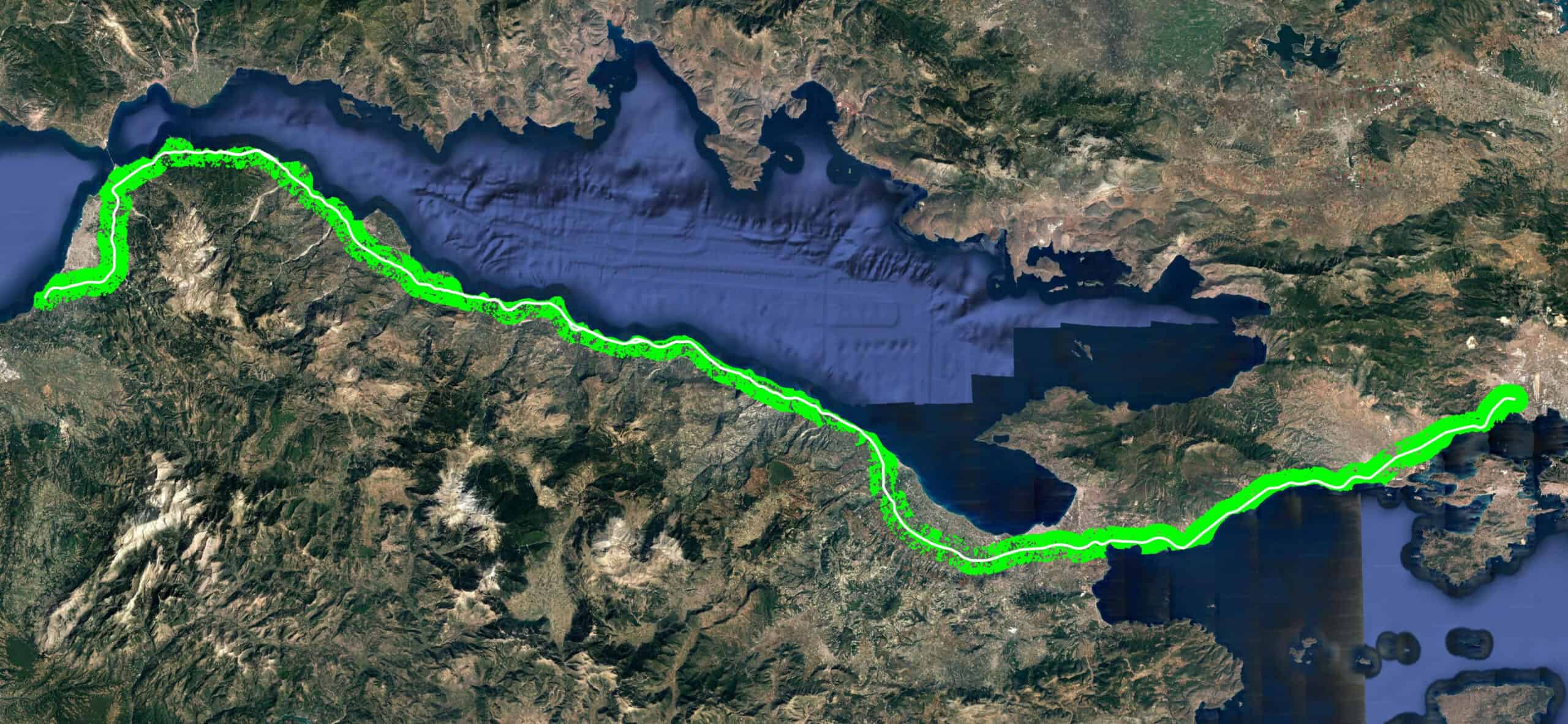
With the large size of radar satellite images, Sixense’s ATLAS InSAR solution is particularly suited to performing inventories of critical areas affecting large linear infrastructures over several hundreds of miles, such as railways, highways and pipelines.
Naturally occuring subsidence/heave, active slope failures, and areas prone to landlside can be easily identified along the infrastructure and solutions to mitigate ongoing movement issues can be implemented.
Risk analysis, sustainability and urban planning
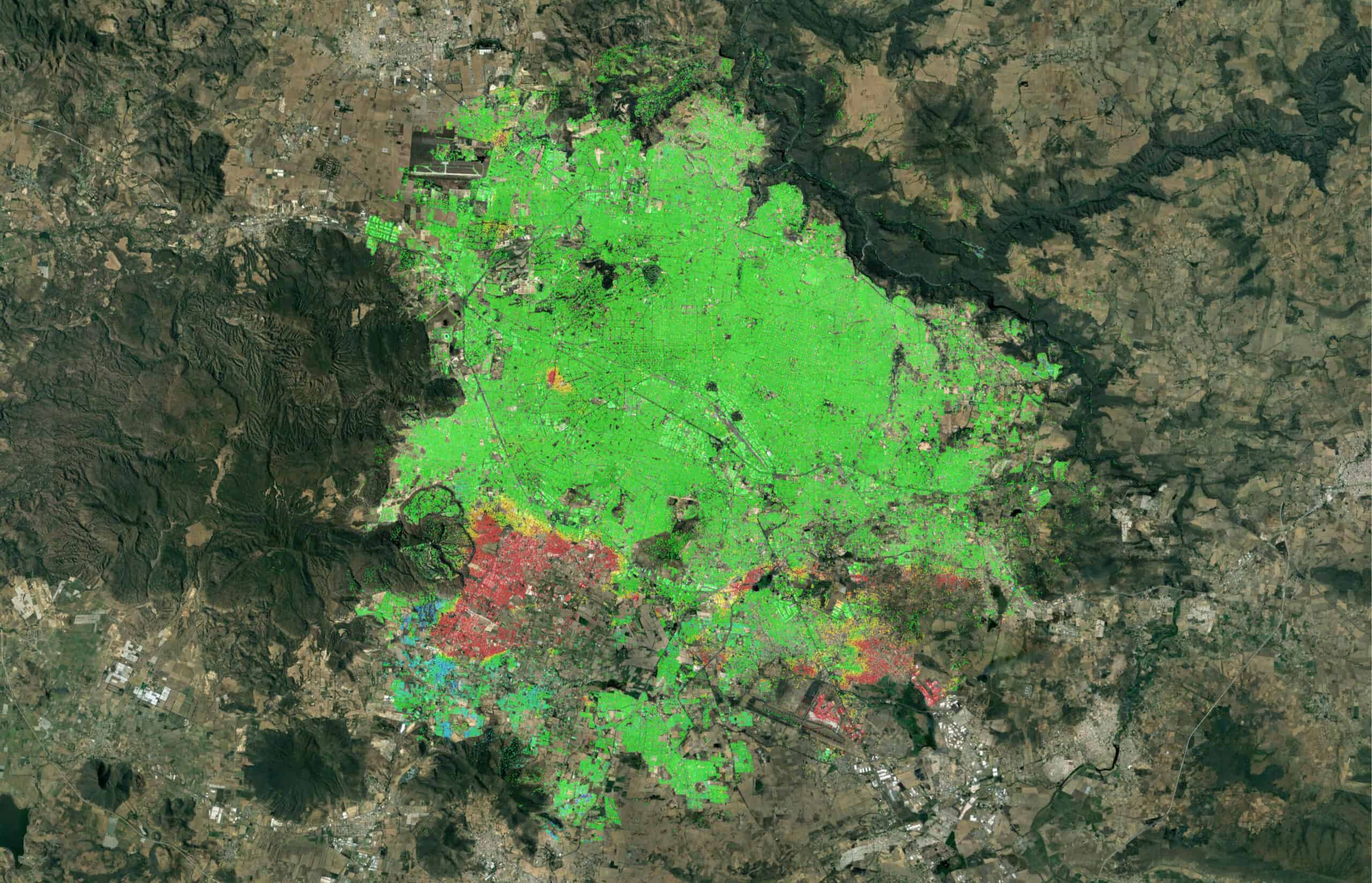
ATLAS InSAR historical studies can be performed at ‘regional scale’ anywhere – it is a solution that is often used on large cities.
On these occasions Sixense’s ATLAS solution becomes a tool for local authorities and land owners to understand zones at risk, or experiencing vulnerabilities that may affect city growth.
Situations such as subsidence triggered by overexploitation of aquifers, areas of sedimental compaction, coastal erosion, flood zones that may threaten the integrity of infrastructure, community safety and more…
ATLAS InSAR contributes to the implementation of strategic and sustainable territory development plans.
Optimisation and implementation of an efficient instrumentation plan
ATLAS InSAR’s historical studies can be used to identify pre-exisiting ground deformations prior to construction works starting, thus permitting the optimisation of any ‘traditional’ real-time or manual monitoring regimes.
ATLAS InSAR, combined with Sixense expertise in structural and geotechnical instrumentation, help us develop bespoke solutions for our client’s project thus implementing an effective and cost opimised monitoring solution.
Legal claims protection
ATLAS InSAR historical studies make it possible to obtain historic ground motion maps beyond the zone of influence (ZoI) and to identify infrastructures and buildings already affected by deformation, prior the start of the works.
In many countries, and for the last few years, Sixense’s ATLAS InSAR has been used as an efficient tool against unjustified claims, providing unambiguous s evidence in legal disputes.
Sixense teams support claims managers in the use of the data.


